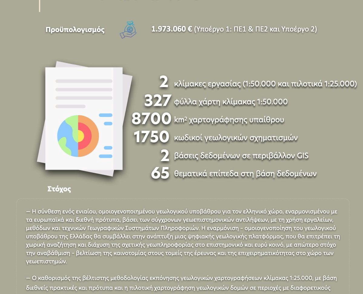
Within the framework of the GEOINFRA project, 327 geological maps of the Greek territory at a scale of 1:50,000 are being revised, updated, and harmonized based on the latest geotectonic theories and scientific studies, while the unified codification system of geological formations is being finalized.
In addition, the optimal methodology for conducting geological mapping and producing modern digital geological maps at a scale of 1:25,000 in pilot areas is being defined.
Find more information about the Project here  https://bit.ly/3MmedDk