The Hellenic Survey of Geology and Mineral Exploration (H.S.G.M.E.) has completed the inventory of water boreholes in the Water District of Thessaly, within the framework of the project S.A.M.Y. II “Systematic inventory of water boreholes for all uses throughout the country,” implemented by H.S.G.M.E. and funded by the Ministry of Environment and Energy through the Operational Programme “Transport Infrastructure, Environment and Sustainable Development” (ΥΜΕPΕRΑΑ).
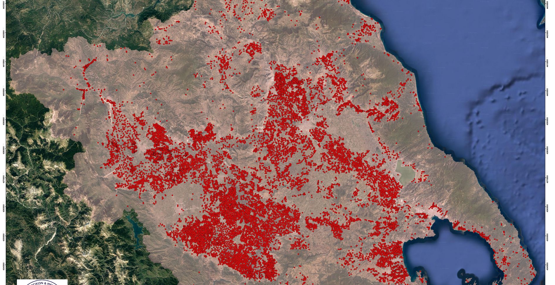
A total of 21,894 water boreholes were recorded, with the Prefectures of Larissa (8,411 boreholes), Karditsa (6,312), Trikala (2,800) and Magnesia (2,594) accounting for 92% of all boreholes within the Water District.
The work was carried out through field inspections by teams from the Regional Units of Western Macedonia and Epirus, and the Central Service of H.S.G.M.E., involving on-site data collection and completion of inventory forms containing technical, informational, measurement, and usage data. The collected data have been integrated into the project’s comprehensive digital geodatabase.
During the fieldwork, data were collected on the operational condition of each borehole, its primary and secondary use, technical specifications, depth, pumping capacity, type and size of irrigated area, and pumping frequency. Where feasible, in-situ measurements of electrical conductivity (E.C. μS/cm) and groundwater level depth (m) were also performed.
Based on the recorded data, thirty-three (33) Technical Reports were prepared for the delineated Groundwater Bodies (Υ.Υ.S.) within the Thessaly River Basin Management Plan. These reports include statistical analysis and data processing to draw conclusions on key parameters derived from the inventory forms, mapping of all parameters on thematic maps, and estimation of water balance components, classifying each groundwater body as either surplus or deficit.
The reports revealed that the major groundwater bodies containing the highest number of active boreholes are classified as deficit. Furthermore, it was found that approximately 90% of the total abstracted water volume in the Water District is used for irrigation, 6.7% for livestock, 1.6% for domestic use, and 1.7% for industrial and other uses.
The S.A.M.Y. II project constitutes a key tool for the effective management of water abstraction volumes and the protection of aquifers from overexploitation. The quantification of abstracted water volumes is a critical parameter for calculating water balances, assessing the status of Groundwater Bodies, identifying pressures, and adopting suitable measures for their sustainable management.
The project outcomes support the initiatives of the General Directorate of Water of the Ministry of Environment and Energy (ΥPΕΝ) and aim to strengthen the national water policy, ensuring both the quality and quantity of the country’s water resources, while complying with European Union Directives (2000/60/EC, 2006/118/EC, and 91/676/EEC).
The project is funded by the Operational Programme “Transport Infrastructure, Environment and Sustainable Development” of the NSRF 2014–2020 (2023).