Through the processing and analysis of the first available satellite images from the “Copernicus” system, the Hellenic Survey of Geology and Mineral Exploration (H.S.G.M.E.) promptly carried out a preliminary assessment of the impacts caused by the recent wildfire in Schinos, Corinthia.
Specifically, Dr. Mariánthi Stefouli, Geologist at the Department of General Geology, Geological Mapping and Applications (GEXAE) of H.S.G.M.E., utilized:
– the topographic background of the Hellenic Military Geographical Service (HMGS),
– the digital elevation model with 5 m resolution from the Hellenic Cadastre (2009–2012 acquisition), and
– the Sentinel-2 satellite image dated 2021-05-20T09:05:59.024Z,
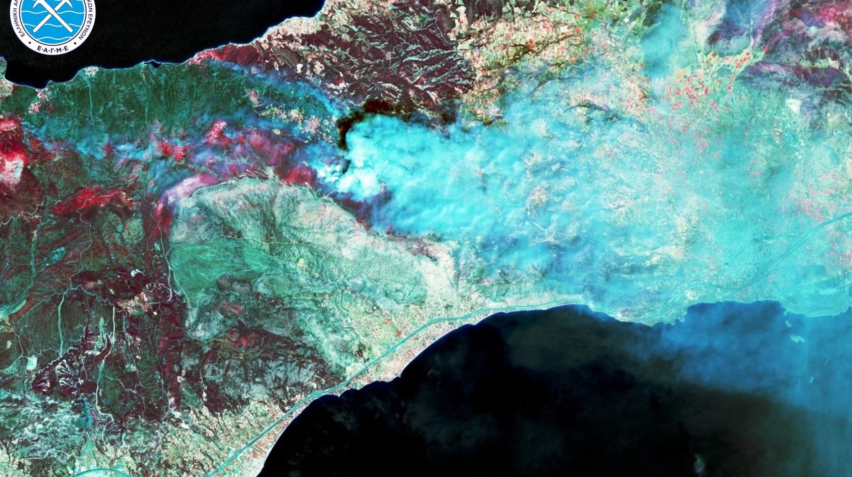
to produce an initial estimate of the burned area from the May 19, 2021 wildfire, as well as the smoke dispersion pattern carried by the wind toward the Attica region.

The H.S.G.M.E. will continue to analyze all available data in order to promptly assess the damage caused by the wildfire, as well as to evaluate potential risks of future natural hazards such as landslides, slope failures, or flooding.

3D representation of the burned area and the active fire fronts at the time of satellite image capture. The map shows the fire’s extent as of the morning of May 20, 2021. [Schinos, Corinthia Wildfire]
*The header image shows the satellite image using spectral bands 8/4/3, depicting the dispersion of smoke carried by the wind toward the Attica region. [Schinos, Corinthia Wildfire]