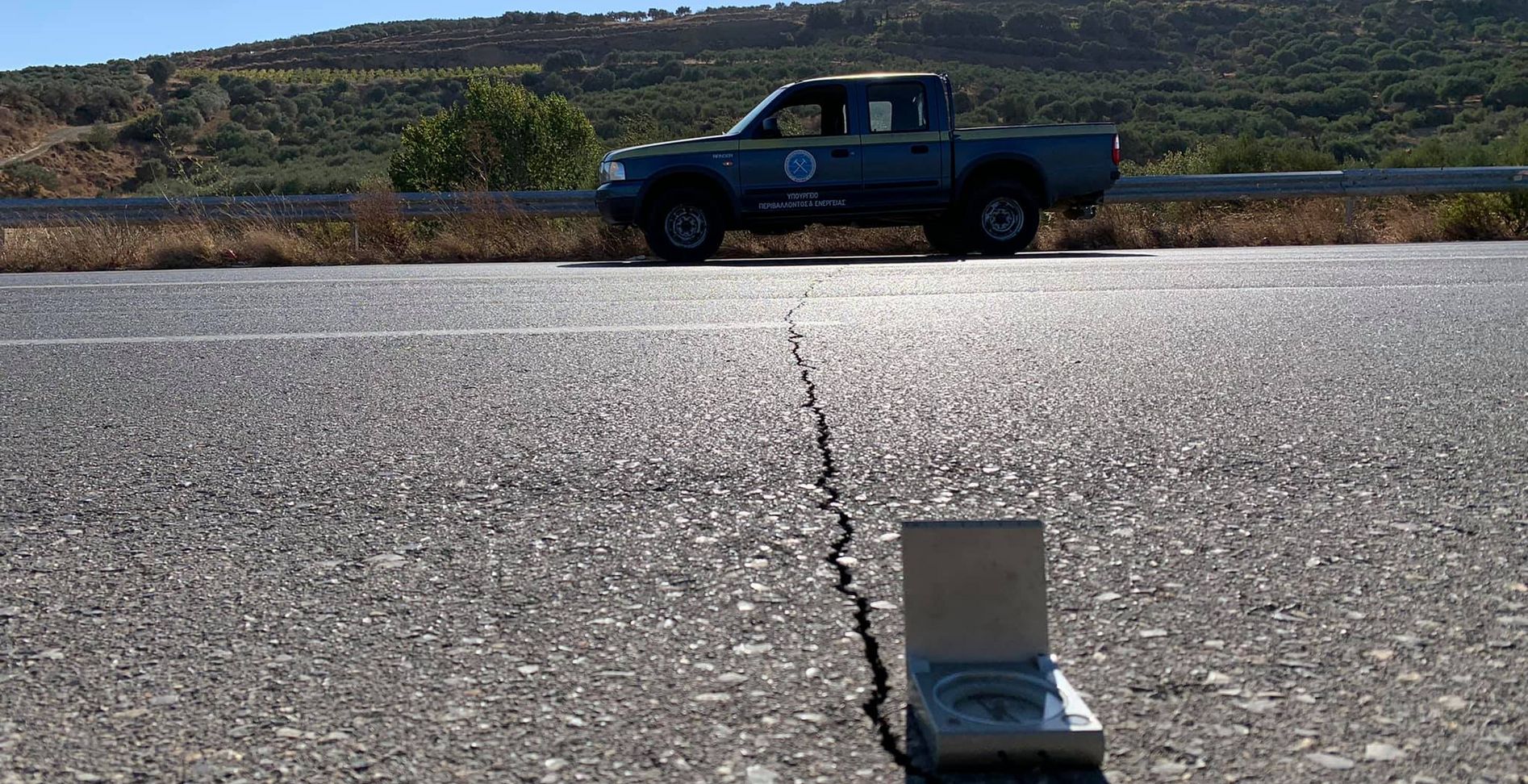
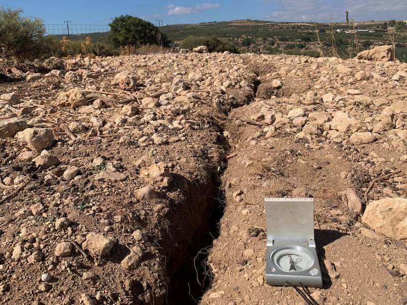
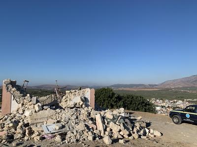
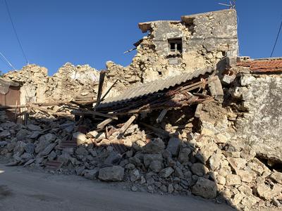
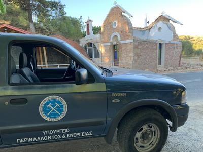
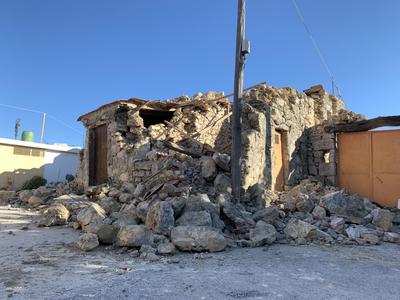
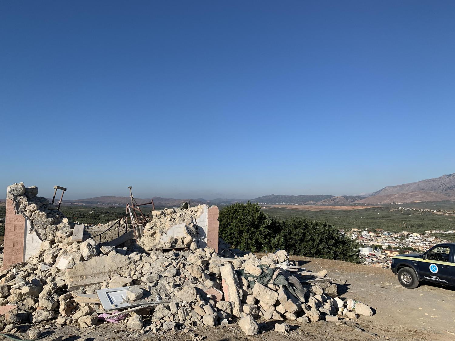
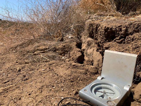
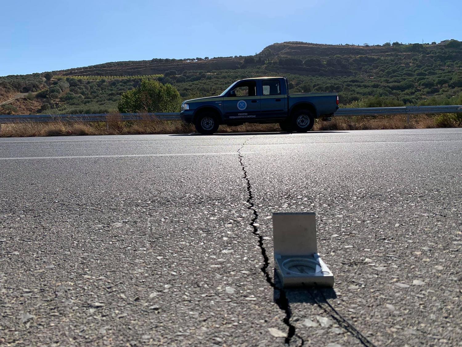
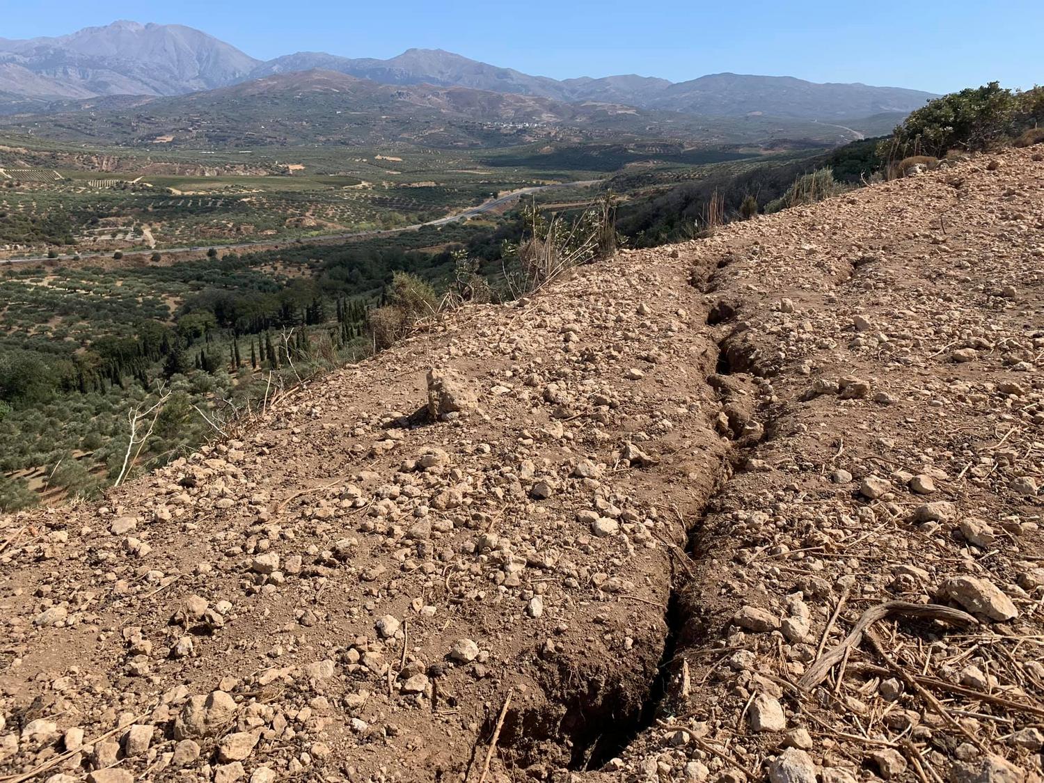
Primary data and correlation with the geological background of the earthquake-affected areas are being analyzed by the Rapid Response Team of the Hellenic Survey of Geology and Mineral Exploration (H.S.G.M.E.), which arrived in the wider Arkalochori area just a few hours after the devastating earthquake of September 27, within the framework of a cooperation memorandum with the General Secretariat for Civil Protection.
Members of the team are currently in the Panorama area of the Municipality of Minoa for on-site assessment. As stated in an interview with SKAI Crete 92.1 and Eleni Vakethianaki, the Head of the Regional Unit of Crete of H.S.G.M.E., Giannis Michalakis, in the coming days, geologists with more specialized expertise will visit the earthquake-affected areas to conduct a more thorough evaluation of the surface manifestations of the earthquake, in cooperation with local authorities. A similar investigation has also been requested by the Municipality of Heraklion for the Venetian Walls, where damage has also been observed as a result of the earthquake.
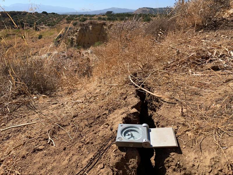
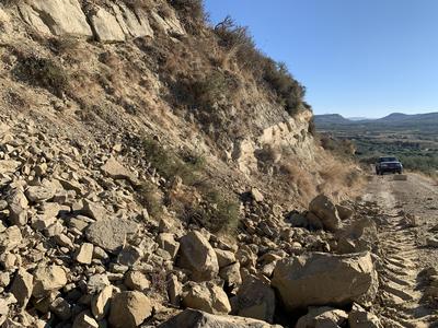
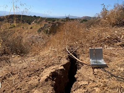
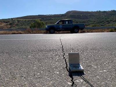
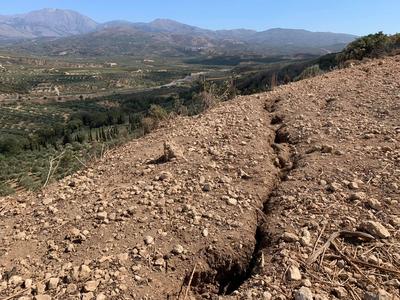
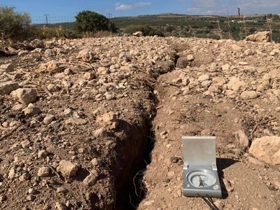
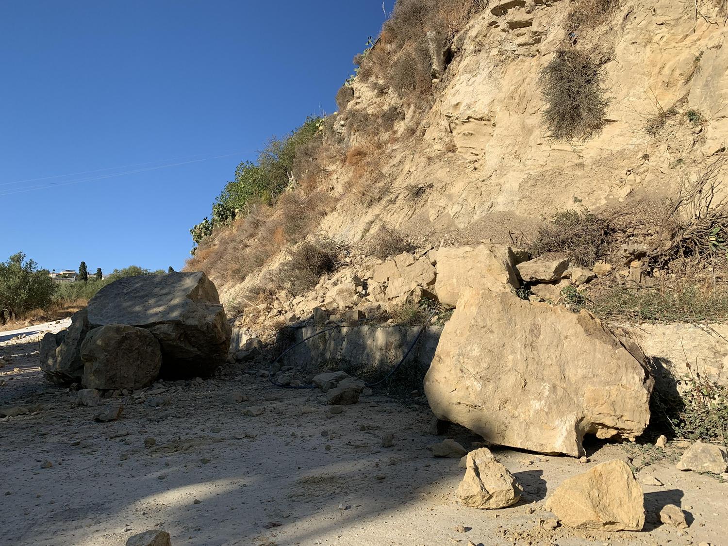
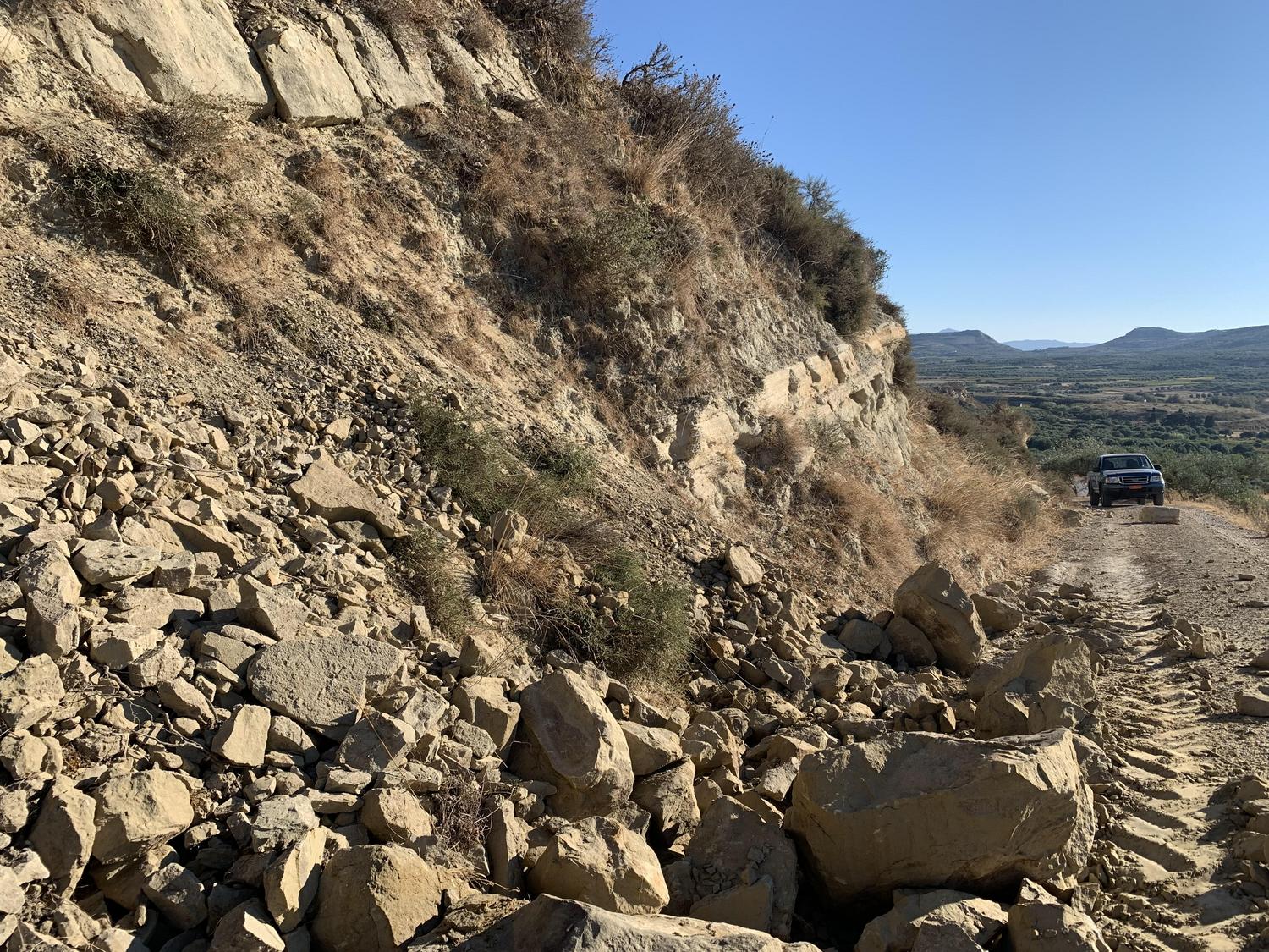
“We are investigating these surface manifestations in order to assess their potential hazards. We have already conducted field inspections in areas such as Arkalochori, Thrapsano, Roussochoria, Archontiko, Boni, Episkopi, and Sgourokefali, among others—locations where rockfalls mainly occurred as a result of the seismic event. The goal is to evaluate slope stability to identify areas that could potentially be at risk after the earthquake, enabling immediate assessment and management of geological hazards. In fact, the Region of Crete has had a plan in place since December 2020 to address such situations,” stated Mr. Michalakis.
It should be noted that H.S.G.M.E. is the national authority responsible for geological mapping, fundamental geological research, and the study of the country’s mining history, marking over a century of geological service in Greece. “Geological mapping is a particularly demanding and complex task involving a wide range of specialized scientists. As a result, we now have a highly detailed representation of the geological background, rich in information, making it an invaluable tool,” added Mr. Michalakis.

Source: creta24.gr


